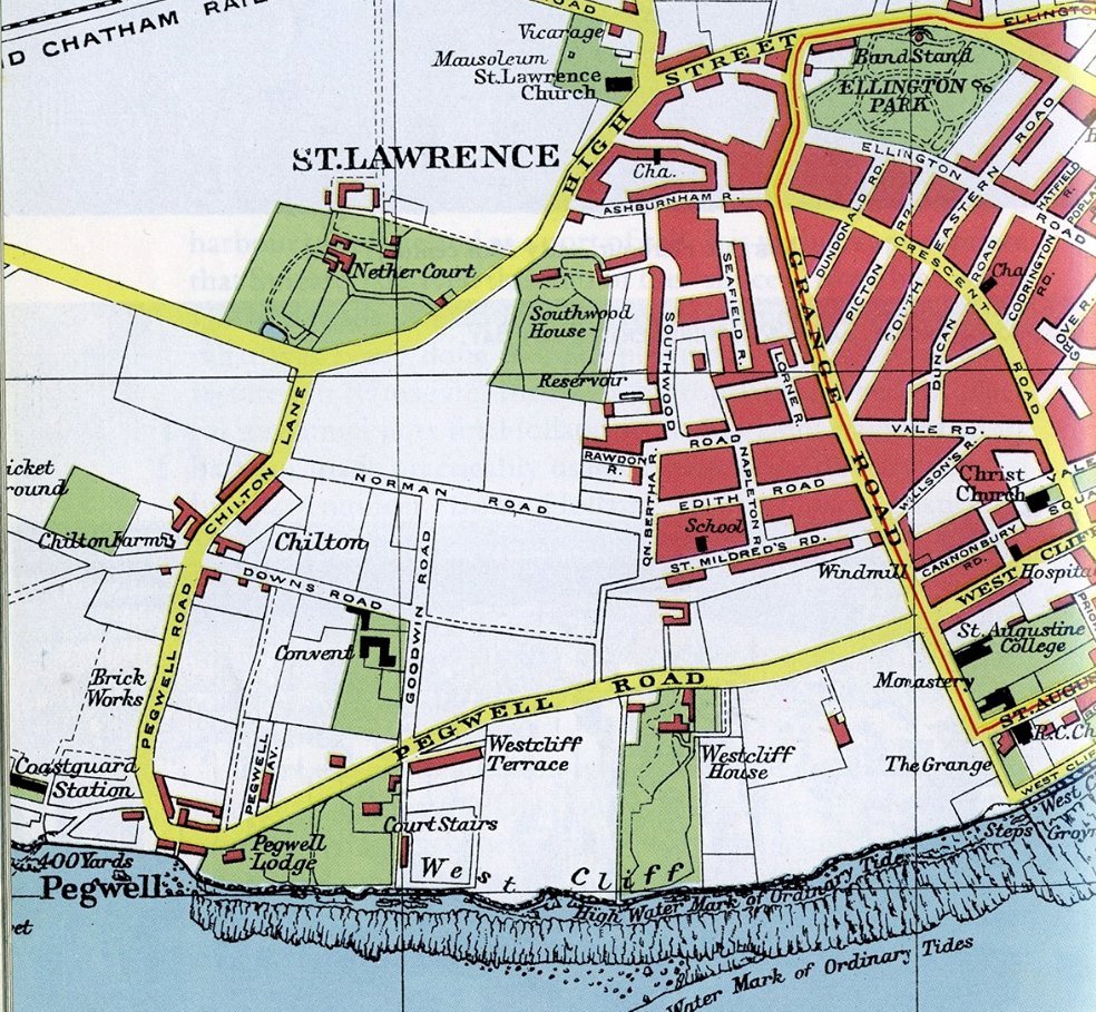
St Lawrence once the original parish which incorporated a small fishing village.
In 1870-72, John Marius Wilson's Imperial Gazetteer of England and Wales described St Lawrence like this:
"LAWRENCE (ST.), a village and a parish in Thanet district, Kent. The village stands near the coast, adjacent to the Ramsgate and Canterbury railway, at the j unction station of Pegwell, ½ a mile W of Ramsgate. The parish was at first a chapelry of Minster; was made parochial in 1275; and included what is now Ramsgate parish till 1827. It contains the tythings of Ozengell and Newlands; the hamlets of Southwood, Pegwell, Chilton, Little-Cliff's-End, Great-Cliff's-End, Manston, Poleash, Spratting-Street, Coldswood, Haine, Newington, Puddle-Dock, and Whitehall; part of Ellington hamlet; and parts of Northwood, Poisons, Holycondane, Dumpton, and Hereson...."


More views around St Lawrence


From British History online
"ST. LAURENCE.
THE PARISH OF ST. LAURENCE lies the next southward from that of St. Peter last described, taking its name from the saint to which the church is dedicated. The ville Ramsgate, within this parish, is within the liberty of the cinque ports; but the rest of the parish is within the hundred of Ringslow and jurisdiction of the justices of the county.
The VILLAGE OF ST. LAURENCE, having the church on an hill on the west side of it, is neat and small, being pleasantly situated in the south-east part of this parish, and commands one of the most extensive prospects in this island, as well towards the sea as the neighbouring parts of the county. This parish is about three miles from east to west, and two miles from north to south. The lands in it are more enclosed than the more northern parishes before-described. It is very populous, and has in it several small hamlets, or knots of houses, besides those particularly mentioned before; among which, in the western part of it, are Manston-green, and Spratingstreet; on the northern, Hains, and Lymington; on the eastern, Hallicandane, and Herson; and towards the south, Great and Little Cliffsend, Chilson, Courtstairs; and adjoining to the sea, Pegwell, alias Courtis a small manor, usually stiled Pegwell, alias Courtstairs, and is an appendage to that of Sheriffs court, in Minster, as has been taken notice of before, in the description of that estate.
Adjoining is Courtstairs, alias Pegwell bay, where the inhabitants catch shrimps, lobsters, soles, mullets,& c. and a delicious flat-fish, called a prill, much sought after. At Pegwell there is a neat villa, lately erected by William Garrow, esq. for his occasional residence, and between this place and Ramsgate is another, called Belmont, an elegant building in the gothic taste, late the residence of Joseph Ruse, esq.
From this bay to a place called Cliffs-end, instead of chalk, the ground next the sea is a sort of blueish earth, somewhat like Fuller's earth; it is about sixteen feet above the sand, and in it are seen strata of culver and other fish shells, lying in a confused manner, one on the top of the other. This earth has been carried away frequently by people, as Fuller's earth, in great quantities, to dispose of as such; but on a trial it was found very deficient, and not partaking of any quality belonging to it.
By the return made by archbishop Parker, in 1563, to the privy council, it appears that there were then here ninety-eight housholds; but this place, owing to the prosperity of Ramsgate, has greatly increased for many years past, insomuch that in 1773, here were in this parish, including Ramsgate, which contains more than two thirds of the houses and inhabitants of the whole parish, 699 houses, and 2726 inhabitants; and in 1792 there were found 825 houses and 3601 inhabitants; which is a great increase for so short a space as nineteen years. A fair is held here yearly, on August 10, for toys, pedlary, &c.
In this parish lived one Joy, who in king William's reign had such a reputation for very extraordinary strength of body, that he was called the English Sampson, and the strong man of Kent, and was taken notice of by the king, royal family, and the nobility, before whom he performed his feats. In 1699 his picture was engraved, and round it several representations of his performances, as pulling against an extraordinary strong horse, breaking a rope, which would bear thirty-five hundred weight, and lifting a weight of 2240lb. He was drowned in 1734.
In the month of March, 1764, between Ramsgate and Pegwell in this parish, a part of the cliff, seventy feet high, on the surface of which was a corn field, gave way for about twenty yards in length, and five yards in breadth, and fell into the sea."